This page contains sample interpretation results from the following publication: Parker D., Wijaya A., Tosiani A., Yazid M., Sari I.L., Kartika T., Kustiyo, Firmansyah R., Said Z., Potapov P., Tyukavina A., Stehman S., Zalles V., Pickens A., Pickering J., Turubanova S., Hansen M.C. (2023, in preparation) Land in Limbo: nearly one third of Indonesia's cleared old-growth forests left idle.
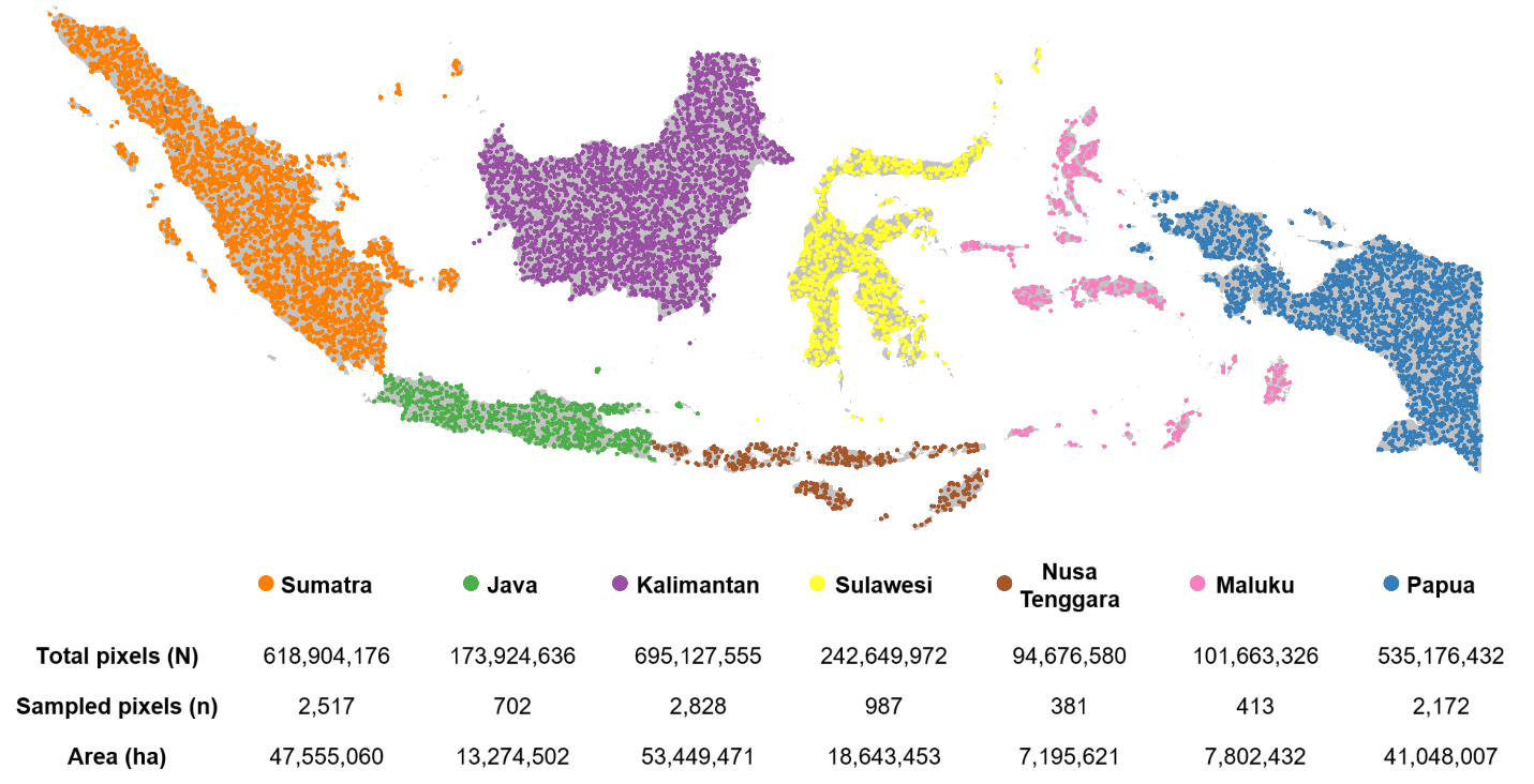
Forest and land use change areas were estimated using reference data based on visual interpretation of satellite imagery. Sample units were 0.00025° pixels, with 10,000 units selected randomly from seven regional strata. The sample size per stratum was proportional to the region’s area. The areas, sample sizes, and sampled pixel locations for each stratum are provided in the map below.
Links to specific regions can be used to access the sample data and interpretation results. Sample data includes annual, bimonthly, and 16-day Landsat composites for sampled pixels and the surrounding area, graphs of annual minimum and maximum Normalized Difference Vegetation Index (NDVI) values and 16-day NDVI, SWIR1, and SWIR2 values for the sampled pixels, graphs of MODIS active fire detections within a 5-kilometer radius of the sampled pixels, high resolution SPOT 6/7 composites for the 2013-2020 period, and links to KML files for each sampled pixel that can be opened in Google Earth.