|
|

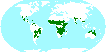
Biome boundary
(drytropicsbiome.zip 111 KB)
The Dry Tropical and Subtropical Forest and Woodland biome was delineated using the World Wildlife Fund terrestrial ecoregions map. This map was modified to add ecoregions of montane forests and coastal forest mosaic in Africa. For the purpose of the sampling analysis, the biome was partitioned into a sampling frame consisting of square blocks 18.5 km per side. The shapefile contains the sampling frame boundary for the biome.
Data format: ESRI shape
Projection: Lat/Long
Landsat-calibrated data
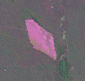
Forest cover for year 2000
(drytropics_forest_20km.zip 106 KB)
This dataset represents forest cover extent for the biome for year 2000. Forests were defined as areas with tree canopy cover greater than 25%. The Landsat-analyzed sample block classification results were used to calibrate biome-wide MODIS-derived forest extent. The relationship between Landsat-based forest cover area and mean VCF tree canopy density per sample block 18.5 km per side was used to derive forest extent for year 2000. A simple linear regression (no intercept) model was used with mean VCF tree canopy density per block as the independent variable.
Data format: GeoTiff. 32-bit data.
Pixel size: 18532.508m.
Projection: Sinusoidal.
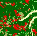
Forest cover loss 2000-2005
(drytropics_change_20km.zip 41 KB)
This dataset represents 2000-2005 gross forest cover loss for the biome. A separate regression estimator (i.e. separate regression models and parameter estimates allowed for each stratum) and post-stratification were employed to estimate Landsat-calibrated forest cover loss area. For sample blocks with intensive change a simple linear regression model was applied using the proportion of area within the sample block classified as MODIS-derived forest loss as the auxiliary variable. For low-change blocks post-stratification based on VCF tree canopy cover was implemented to partition blocks into areas of nearly zero change and areas of some change. The forest cover loss area estimates were then constructed from the sample mean Landsat-derived clearing within post-strata.
Data format: GeoTiff. 32-bit data.
Pixel size: 18532.508m.
Projection: Sinusoidal.
Provided MODIS-derived data are available for use for valid scientific, conservation, and educational purposes as long as proper citations are used. We ask that you credit the Global Forest Monitoring data as follows:
Hansen M., Stehman S., Potapov P. (2010) Quantification of global gross forest cover loss.
Proceedings of the National Academy of Sciences of the U.S.A.
We ask that you credit the Vegetation Continuous Fields data as follows:
Hansen, M., DeFries R.S., Townshend J.R.G., Carroll M., Dimiceli C., Sohlberg R.A. (2003) Global Percent Tree Cover at a Spatial Resolution of 500 Meters: First Results of the MODIS Vegetation Continuous Fields Algorithm. Earth Interactions, Vol 7, No 10, pp 1-15.
For further information, please contact:
Dr. Matthew Hansen
Geographic Information Science Center of Excellence - SDSU
Phone: (605) 688-6848
Matthew.Hansen@sdstate.edu
Dr. Peter Potapov
Geographic Information Science Center of Excellence - SDSU
Phone: (605) 688-5814
Peter.Potapov@sdstate.edu
|