|
|

The estimation of biome-wide forest cover and forest cover loss is based on a probability-based sampling approach employing multi-resolution satellite data. Biome-wide change indicator maps were created using moderate spatial resolution imagery for 2000 to 2005 from the MODerate Resolution Imaging Spectroradiometer sensor (MODIS). These change indicator maps were used to stratify the respective biomes into high, medium and low change likelihood strata. Subsequent samples of 18.5km by 18.5km blocks of high spatial resolution image pairs from the Landsat ETM+ sensor were taken within each stratum and used to determine biome-wide area of forest clearing. The sampling strategy employed the MODIS data in the design to stratify the blocks and also in the analysis via a survey sampling regression estimator of forest clearing. This statistically rigorous sampling strategy provides a biome-level clearing estimate with known uncertainty.
Forest cover monitoring method and products
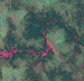
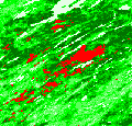
Biome-wide forest change hotspot maps were created using annual MODIS imagery for 2000 to 2005. MODIS 32-day composites were used as inputs and included data from the 1-7 reflective bands and Land Surface Temperature. In order to produce a more generalized annual feature space that enabled the extension of spectral signatures to regional and inter-annual scales, the 32-day composites were transformed to multi-temporal annual metrics. The regression tree bagging algorithm related the training data derived from single-date spring 250m MODIS granules that were classified into forest cover loss and no change categories to the MODIS inputs. The regression tree yielded per MODIS pixel 5-year forest loss fraction maps. We applied a 5% sub-pixel forest loss fraction threshold to produce per 500m pixel forest change/no change hotspot map for stratification. This map and the tree canopy cover data showing forest extent for year 2000 are available for download. These data represent areas of intensive forest cover clearing. However, MODIS data alone are inadequate for accurate change area estimation because most forest clearing occurs at sub-MODIS pixel scales.
Annual MODIS-derived change hotspot maps were used for the analysis of temporal trends of forest canopy loss within biome and regions. Although MODIS hotspot maps are inadequate for accurate annual change area estimation, this dataset could be used for large-scale change temporal trend analysis.
The analysis of forest cover loss factors was based on a decision tree classification using a bagging technique. The objective was to discern the cause of the cleared forest cover per MODIS pixel. An extensive training set was manually created using available ancillary information. A sample of pixels within the final change hotspot mask was manually labeled as burned areas and other (logging, tree mortality due to insect outbreaks, windfalls). The classification results (probability of each class per pixel) were thresholded at 50% to produce two categories: burned areas and forest cover loss hotspots attributed to other disturbance factors (including logging, insect outbreaks, wind and human-caused disturbance).
The MODIS forest loss hotspots were used to generate percent hotspot values per 18.5 km sample blocks and then used to stratify the biome into regions of high, medium and low likelihood of forest cover loss. Blocks were sampled within each stratum and characterized into forest cover loss using multi-date Landsat ETM+ imagery. Each Landsat sample block was classified using a supervised decision tree classifier to yield 2000 forest cover and 2000 to 2005 forest clearing areas. Forest was defined as greater than 25% canopy cover and change was measured without regard to forest land use. All blocks used in this analysis can be viewed at the Landsat Supplementary Data page.
The Landsat-derived calibration data were used to estimate forest cover and forest cover loss within the biome using a regression estimator employing MODIS change hotspot fraction as auxiliary variable. The final Landsat-calibrated biome-wide dataset with spatial resolution 18.5 km quantifying forest cover for 2000 and forest cover loss from 2000 to 2005 is available for download.
Provided MODIS-derived data are available for use for valid scientific, conservation, and educational purposes as long as proper citations are used. We ask that you credit the Boreal Forest Monitoring data as follows:
Potapov P., Hansen M. C., Stehman S. V., Loveland T. R., Pittman K. (2008) Combining MODIS and Landsat imagery to estimate and map boreal forest cover loss. Remote Sensing of Environment, 112(9), 3708-3719.
For further information, please contact:
Dr. Matthew Hansen
Geographic Information Science Center of Excellence - SDSU
Phone: (605) 688-6848
Matthew.Hansen@sdstate.edu
Dr. Peter Potapov
Geographic Information Science Center of Excellence - SDSU
Phone: (605) 688-5814
Peter.Potapov@sdstate.edu
|


