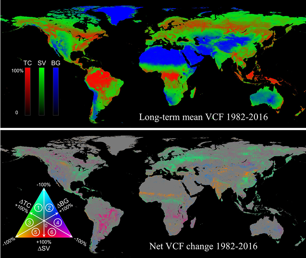
Changes in land cover and land use significantly affect earth system processes including the carbon cycle, the water cycle, species diversity, and socioeconomic development. Vegetation continuous fields (VCF) represent land surface as a fractional combination of vegetation functional types that can be remotely sensed from satellites. Using daily satellite observations acquired by the Advanced Very High Resolution Radiometer (AVHRR), we developed an annual VCF product consisting of tree canopy (TC) cover, short vegetation (SV) cover and bare ground (BG) cover and characterized land change over the past 35 years (1982-2016).
Here we present three global map layers representing net changes in TC, SV and BG, respectively. All layers are in Geographical Latitude / Longitude projection (WGS84) and each pixel is 0.05° × 0.05° in size. Pixel values (-100 to 100) represent net percent change over the 35-year period. Negative values represent loss; positive values represent gain; 0 represents no change.
We ask you to credit the downloadable data with the following citation:
Song, X.P., Hansen, M.C., Stehman, S.V., Potapov, P.V., Tyukavina, A., Vermote, E.F., & Townshend, J.R. (2018). Global land change 1982-2016. Nature 560, 639–643.
Data Links:
Bare_ground_change_1982-2016.tif
Short_vegetation_change_1982-2016.tif
Tree_canopy_change_1982-2016.tif

